


- 18Holes
- 72Par
- 5Rated tees
- 18Greens mapped
- 160Contours
- 11.7%Steepest slope
About The River
The River Golf Course, Inc. is an 18-hole golf course playing to par 72 in International Falls, Minnesota. Joel Goldstrand designed it, and it opened in 1998. GolfCore has mapped 18 greens here with contour lines and fall-line arrows. The card below lists 5 rated tees with yardages for all 18 holes. GPS yardages and scoring are free in the GolfCore app.
Plan your visit
1500 2nd Ave, International Falls, MN 56649
+1 218-283-3553
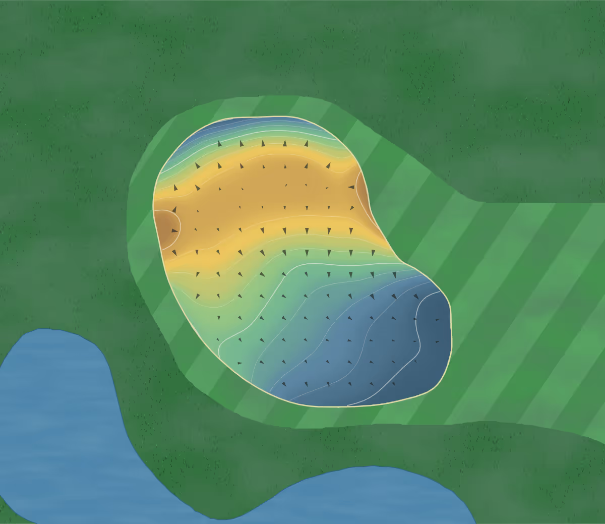
How the greens break
GolfCore traced 18 greens at The River from USGS 3DEP 1-meter lidar, with 160 elevation contours at a 3-inch interval. The steepest measured slope is 11.7 percent, and the largest rise across a single green is 4.2 ft.
In the app the same map sits under your ball on every green, with the fall line drawn to the hole and the wind modeled at your position. At clubs that run GolfCore, the pins the shop sets each morning show up there too.
Elevation: USGS 3D Elevation Program, U.S. Geological Survey, National Geospatial Program (public domain), processed by GolfCore.
The card
| Hole | 1 | 2 | 3 | 4 | 5 | 6 | 7 | 8 | 9 | Out |
|---|---|---|---|---|---|---|---|---|---|---|
| Par | 4 | 4 | 4 | 5 | 5 | 3 | 4 | 4 | 4 | 37 |
| Hcp | 7 | 11 | 3 | 1 | 9 | 17 | 5 | 13 | 15 |
| Hole | 10 | 11 | 12 | 13 | 14 | 15 | 16 | 17 | 18 | In |
|---|---|---|---|---|---|---|---|---|---|---|
| Par | 4 | 3 | 5 | 4 | 3 | 5 | 3 | 4 | 4 | 35 |
| Hcp | 12 | 10 | 2 | 6 | 16 | 8 | 14 | 18 | 4 |
Total72
| Hole | Par | Hcp |
|---|---|---|
| 1 | 4 | 7 |
| 2 | 4 | 11 |
| 3 | 4 | 3 |
| 4 | 5 | 1 |
| 5 | 5 | 9 |
| 6 | 3 | 17 |
| 7 | 4 | 5 |
| 8 | 4 | 13 |
| 9 | 4 | 15 |
| Out | 37 | |
| 10 | 4 | 12 |
| 11 | 3 | 10 |
| 12 | 5 | 2 |
| 13 | 4 | 6 |
| 14 | 3 | 16 |
| 15 | 5 | 8 |
| 16 | 3 | 14 |
| 17 | 4 | 18 |
| 18 | 4 | 4 |
| In | 35 | |
| Total | 72 |
Course rating and slope
| Tee | Yards | Par | Rating / Slope |
|---|---|---|---|
| Blue | 6,632 | 72 | 71.9 / 122 |
| White | 6,233 | 72 | 70.0 / 118 |
| Gold | 5,795 | 72 | 68.0 / 114 |
| Gold (L) | 5,795 | 72 | 73.1 / 122 (W) |
| Red (L) | 5,141 | 72 | 69.4 / 115 (W) |
Hole data is what GolfCore holds for the course's layout. Picking a tee shows that tee's own yardages, pars and stroke indexes where the club has rated them. Spot a wrong par, yardage or stroke index? Report it from Map Settings in the app, or send us a correction.
Course details
- Location
- International Falls, Minnesota, United States
- Address
- 1500 2nd Ave, International Falls, MN 56649
- Phone
- +1 218-283-3553
- Website
- rivergolf.com
- Architect
- Joel Goldstrand
- Opened
- 1998
- Holes
- 18
- Par
- 72
- Tees on the card
- 5, 5 USGA-rated
- Greens mapped
- 18
- Elevation contours
- 160
- Contour interval
- 3-inch
- Largest green elevation span
- 4.2 ft
- Steepest measured slope
- 11.7%
- Course map
- Traced hole by hole
- Wind modeling
- Live wind grid, 16 directions
- Tree canopy
- 1-meter canopy height model
- Course data updated
- 2026-10-13
More courses nearby
Straight-line distance from The River Golf Course, Inc..
-
 Oak Harbor Golf Course
Baudette, Minnesota59.2 mi straight-line
18 holes, par 72, scorecard, course map, green maps
- Vermilion River Greens
Minnesota52.8 mi straight-line
9 holes, par 36, scorecard, course map, green maps
-
 Golf on The Edge
Bigfork, Minnesota57.6 mi straight-line
9 holes, par 36, scorecard, green maps
- Heron Landing
5.9 mi straight-line
15 holes, scorecard, green maps
- Spruce Creek
Sleeman50.6 mi straight-line
9 holes, scorecard, green maps
- Kitchen Creek Golf & Country Club
Fort Frances2.4 mi straight-line
18 holes, par 72, scorecard
Staff at The River can claim this course by signing in with an email address at the club's own domain, then edit its address, phone, website and crest at no charge. Read how a club keeps its course right. The same system runs a club's tee sheet and caddie yard; read how caddie management on GolfCore works.